Map of African Countries: Complete Guide to 54 Nations
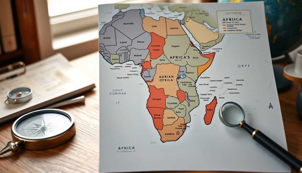
Africa’s scale defies easy summary: 54 countries, 30 million km², and 1.4 billion people spread across deserts, rainforests, and savannas. Whether you’re planning a geography lesson or mapping a travel route, a good map is your first essential tool. According to the Nations Online Project (a geographic reference portal), a political map of Africa shows every country’s borders and capital city — exactly what you need to get started.
Countries in Africa: 54 ·
Total area: 30.37 million km² ·
Estimated population: 1.4 billion ·
Largest country: Algeria (2.38 million km²) ·
Smallest country: Seychelles (451 km²) ·
Number of landlocked countries: 16
Quick snapshot
- 54 sovereign states are internationally recognized (Nations Online Project)
- Each country has an official capital city (WorldAtlas)
- Africa covers about 20% of Earth’s land area (Geology.com)
- Status of Western Sahara (disputed territory claimed by Morocco and the Sahrawi Arab Democratic Republic)
- Recognition of Somaliland as an independent state
- Some countries have multiple de facto capitals (e.g., South Africa)
- 2011: South Sudan becomes 54th recognized African country
- 1963: Formation of the Organisation of African Unity
- Continued diplomatic efforts on Western Sahara status
- Potential recognition changes for Somaliland
Across eight key statistics, one pattern emerges: Africa’s scale is hard to grasp without numbers. Here are the vital figures every map user should know.
| Category | Value |
|---|---|
| Total number of countries | 54 |
| Total area | 30,370,000 km² (11,730,000 sq mi) |
| Approximate population | 1.4 billion (2023 estimate) |
| Largest country by area | Algeria (2,381,741 km²) |
| Smallest country by area | Seychelles (451 km²) |
| Number of landlocked countries | 16 |
| Highest point | Mount Kilimanjaro (5,895 m) |
| Lowest point | Lake Assal, Djibouti (-155 m) |
What are the countries and capitals of Africa?
List of 54 African countries and their capitals
A reliable political map of Africa labels every sovereign state and its capital. According to WorldAtlas (a geography reference site), the table includes the capital for each country — for example, Algeria’s capital is Algiers, Nigeria’s capital is Abuja, Kenya’s capital is Nairobi, and Egypt’s capital is Cairo. South Africa has three capitals: Pretoria (administrative), Cape Town (legislative), and Bloemfontein (judicial). The complete list runs to 54 entries, each tied to a capital city.
For educators printing a classroom map, knowing that Nigeria’s capital is Abuja — not Lagos — prevents outdated labeling. Always cross-check against an authoritative source.
Regions of Africa (North, West, Central, East, Southern)
The Nations Online Project groups Africa into five subregions. North Africa includes countries like Morocco, Algeria, and Egypt. West Africa covers Nigeria, Ghana, and Senegal. Central Africa features the Democratic Republic of the Congo and Cameroon. East Africa includes Kenya, Tanzania, Ethiopia, and Uganda. Southern Africa spans South Africa, Botswana, and Zimbabwe. The United Nations Geoscheme provides a similar breakdown but counts over 20 countries in East Africa alone.
A regional map gives context but can be misleading — the UN classification of Eastern Africa differs from the East African Community membership list.
Where can I find a PDF map of African countries?
Free downloadable PDF maps
Several reputable sites offer free PDF maps of Africa for classroom or personal use. Alabama Maps (a university geography resource) provides separate PDF files for countries and capitals, available in both PDF and JPEG formats. FreeWorldMaps.net (a cartography site) offers outline maps, political maps, and editable SVG/AI files for Illustrator. GIS Geography (a mapping education site) lets users download a free political map with capitals labeled.
Maps with capitals and major cities
Some resources go beyond simple country outlines. Geology.com includes major cities on its satellite and political maps. A high-resolution map hosted at Harvard’s MEI website (an academic portal) displays a large political map at 1600×1690 pixels with capitals and major city labels.
Printable blank maps for education
Blank outline maps are ideal for quizzes and labeling exercises. FreeWorldMaps.net provides black-and-white versions that students can fill in. Alabama Maps also supplies unlabeled PDFs for testing country recognition.
How does a world map show Africa?
Africa’s position on world maps
Africa straddles the equator, with most of its landmass between 35°N and 35°S. It lies south of Europe, between the Atlantic Ocean and the Indian Ocean, as described by Geology.com.
Common map projections and distortions
The Mercator projection — still widely used in classrooms — dramatically distorts the size of landmasses near the poles. Africa appears much smaller than its actual 30.37 million km², while Greenland looks comparable in size even though it is only one-fourteenth Africa’s area. The trade-off: for navigation, Mercator preserves angles; for area comparison, an equal-area projection like Mollweide is more accurate.
Relative size compared to other continents
Africa is the second-largest continent by area, after Asia. It covers about 20% of Earth’s total land area — roughly three times the size of Europe.
Any single world map projection oversimplifies. Teachers should use multiple projections to avoid reinforcing size misconceptions.
How can I view Africa on Google Maps?
Navigate to Africa using Google Maps
Google Maps offers a comprehensive view of Africa. Users can zoom in to see street-level imagery in major cities like Nairobi, Johannesburg, and Casablanca. The search function allows quick location lookups for countries, capitals, and landmarks.
Satellite view vs. map view
Switching to satellite view reveals real terrain — deserts, forests, and urban sprawl — from NASA/ESA imagery. The map view shows political boundaries and road networks. Both layers are free and updated regularly.
Custom markers and route planning
You can drop custom pins, save locations, and plan multi-stop routes. This is especially useful for travelers planning a safari itinerary or teachers marking historical sites. For travelers planning a safari itinerary or teachers marking historical sites, custom markers and route planning are especially useful, and you can view the EFL League Two table here. EFL League Two table
Which countries are in East Africa?
UN classification of Eastern Africa
The United Nations Geoscheme lists 21 countries and territories in Eastern Africa, including Ethiopia, Kenya, Tanzania, Uganda, Rwanda, Burundi, Somalia, Djibouti, Eritrea, South Sudan, and island nations like Madagascar, Seychelles, and Mauritius. The Nations Online Project reflects a similar grouping.
East African Community (EAC) member states
The East African Community is a political and economic bloc with seven members: Burundi, Kenya, Rwanda, South Sudan, Tanzania, Uganda, and the Democratic Republic of the Congo (joined 2022). The EAC aims for regional integration and a single currency.
Major cities and capitals in East Africa
Key capitals include Nairobi (Kenya), Dodoma (Tanzania), Kampala (Uganda), Addis Ababa (Ethiopia), and Mogadishu (Somalia). Major economic hubs like Mombasa, Dar es Salaam, and Nairobi drive the region’s economy.
What does a simple Africa map include?
Essential features of a simple map
A basic Africa map typically shows country boundaries and country names only — no topography, no rivers, no cities. This minimal design is perfect for coloring exercises or introductory geography lessons.
Country borders and labels
Borders are drawn as lines between nations, often color-coded for clarity. Labels are placed in the center of each country or along recognizable coastlines.
Uses in classrooms and presentations
Simple maps are a classroom staple. Teachers use them for quizzes, students label capitals, and presenters embed them in slides to show regional data without visual clutter.
“Africa has 54 countries, all of which are member states of the African Union.”
— Encyclopedia Britannica
The CIA World Factbook provides up-to-date area and population figures for each African country — essential for verifying map statistics.
— CIA World Factbook
The United Nations Geoscheme defines subregions like Eastern Africa with specific country lists, a key reference for regional maps.
— United Nations
The pattern is clear: reliable map data comes from institutional sources like Britannica, the CIA, and the UN. For anyone needing a trustworthy map of Africa, start with these references.
For a closer look at how each of the 54 African nations is recognized internationally, see the full list maintained by the African Union.
Frequently asked questions
What is the largest country in Africa by area?
Algeria, covering 2,381,741 km², is the largest country by area in Africa.
What is the smallest country in Africa?
Seychelles, with an area of just 451 km², is the smallest African country.
What is the most populous country in Africa?
Nigeria is the most populous, with over 223 million people (2023 estimate).
Which African country has the most land borders?
The Democratic Republic of the Congo borders nine countries — the most of any African nation.
Is Madagascar considered part of Africa?
Yes, Madagascar is an island country off the southeast coast and is considered part of Africa both geographically and politically.
What is the capital of Nigeria?
Abuja is the capital of Nigeria, replacing Lagos in 1991.
How many countries in Africa are islands?
Six African countries are island nations: Cape Verde, Comoros, Madagascar, Mauritius, Seychelles, and São Tomé and Príncipe.
What are the major languages spoken in Africa?
Africa is home to over 2,000 languages. Major language families include Afroasiatic (Arabic, Hausa, Amharic), Niger-Congo (Swahili, Yoruba, Zulu), and Nilo-Saharan.
Related reading
More related posts
 In the Heart of the Sea – True Story of Essex Sinking
 2 Stroke Fuel Mix Guide: Ratios, Charts & How to Mix
 NCEA Level 2 English – Standards, Credits and 2025 Guide
 Jake Paul vs Anthony Joshua NZ Time: Watch on Netflix
 Warehouse Stationery Sylvia Park: Store Guide & Services
 Pizza Hut Bell Block – Menu, Phone & Prices
 King’s Birthday Honours NZ 2025: Full List of Recipients & Details
 New World Mount Maunganui: Prices, Hours, Local Ownership Guide
